Contents.
- October Trip and Map
- Ripley to Knaresborough on the Old Railway
- Descent of Water Bag Bank, Knaresborough
- Return using Beryl Burton Cycleway
- Encouraging Cycling
I have the fortune of regularly visiting Nidderdale in North Yorkshire and have posted a number of blogs about it to date, including multiple cycle route videos and an attempt at a fuller guide. There are lots of photos of the stunning scenery along the way as well as the videos and mapping.
This October I revisted with the aim of getting a much higher quality video of a variety of routes I'd not yet tried. I've put up a lot of clips centred on Pateley Bridge separately to this post about the new Nidderdale Greenway starting near the castle in Ripley and trying the routes to Knaresborough and riding in the town itself.
I was a tad misty when we tried the route from Ripley down to Knaresborough along the Nidderdale Greenway. Note that riding in wet weather is far from unpleasant. If your only experience of wet weather is from the inside of a car or house, you lack any knowledge of how easy and fun it is to be out in it. When riding, walking, or just being out in it, your activity becomes your central heating (without the quarterly bill), and the endorphins created ensure you remain happy (without the presciption costs). If you take outdoors activity as something to be moped about, you'll do the same indoors. Also, after being outdoors you CAN eat cake.
View Nidderdale Oct 2014, Ripley Cycle Route in a larger map
Ripley to Knaresborough on the Old Railway (blue).
Click on the square box bottom right to get full screen, well worth it!
This clip starts near the castle in Ripley and is a extension of a previous trip from Summerbridge, the connecting clip of which is here.

Ripley Castle from Hedgehog Cycling
The new Nidderdale Greenway proper starts in the car park just round the corner. Sadly for a new route it starts with a gate. Hmm, slightly worrying. However, at the next field boundary a cattle grid appears. Hooray! Why not in the first boundary? The first section is pleasantly away from the the Harrogate road.

Ripley Stone Sculpture from Hedgehog Cycling
At 1:17, the railway route begins in earnest. This is along the remnants of the railway that went up Nidderdale to Pateley Bridge and beyond. The first part of it wiggles more than the railway would have done, but soon there's a steady straight incline across a depression that reeks of trains.

Nidderdale Greenway from Hedgehog Cycling
Given the success of the current cycleways, there's some suggestion that the entire route up to Pateley Bridge (and further) could get the same treatment. It would make a fabulous tourist draw for the locale, encouraging families to spend a week riding the valley, exploring, and visiting attractions, without the need to get the car busy, much like the Camel Trail in Cornwall. And, yes, this is aimed at families rather than the experienced road rider.
At 2:20 there's a reminder that this is not for cycles only, which does detract a little from it's shine. There are several more reminders of this along the way, although no horses.

Sculpture and bench from Yorkshire Trails
At 2:34 there's a concrete slab crossing for farm vehicles. This is a clever way to get round the often objections from some places that the size of vehicles would damage any cycle infrastructure put in. Nice views as the trees fall away, although it's not quite the same as the upper Nidd valley. It doesn't have the same inclines either!
At 4:05, after a pleasant and straight route, there appears some "roadworks". Bizarrely, the sign asks horse and bike riders to dismount. The route is at least 3 metres wide even through the "roadworks". Why on earth do bike riders need to get off? I understand that you might not want horses to be ridden here (although I'll confess ignorance, horse riders?), but to lump the two together seems like a anachronistic mess. Luckily, the viaduct over the river Nidd directly after is impressive and takes thoughts away from prior stupidness.

Nidd Viaduct View from Hedgehog Cycling
At 4:31 I decided to give the path a speed check. Notice the riders behind disappearing! Nice smooth surface at speed. Tick, successful test. Note that I did this then slowed when other people appeared. Riding at speed is something that needs to be done with good awareness of all that is around, including side entrances. Note that this doesn't get anywhere near the same risk posed with driving at speed.
At 5:15 the road to Bilton Park crosses. This is also where the route that connects the the Beryl Burton Cycleway (below) goes to the left. Just after this the cycleway splits in two with the right fork going right into central Harrogate (great access for shopping) and the left fork going to Starbeck between Harrogate and Knaresborough. We follow this route.
Immediately the route is downgraded with a hardcore surface rather than tarmac. This doesn't bother me much, but I understand those who don't like this. Then, at 5:53, the real trouble with this route throws up it's ugly head: highly restrictive width barriers. The idea is it should stop someone riding a motorbike down here. However, it also stops many types of bike coming down here. No cargo bikes, no box bikes, no trikes or other wider ability-modified bikes. Indeed, it's quite difficult for a standard bike to get through here, as is obvious here. It'd be quite a struggle to get through here with minimal shopping. I'd much rather have he odd motorbike than limit who can ride their cycles down here. At least the tarmac has returned.
At 6:47 there's a link up to the roads. This, in hindsight, would have been a better route as it's a quiet road that gets round a slightly less pleasant part for riding near the centre of Starbeck. And finally another awkward wobble to get into a town estate. Hmm. No signposts, no idea where the route goes from here. Is there a route? Straight on down the road would seem sensible, but then at 7:54, yet again no signposts. Have we accidentally strayed off the cycle route?
Heading up the main road, it's not clear if either pavement is a shared-use route. This seems a bit of a sudden end to a reasonable route, being dumped on a main busy urban road with no signs saying where to go. Eventually we decide that the other side is shared-use, cross to it and proceed. The little signage up doesn't tell us much.
At 9:05 we get some confirmation that we are indeed on a shared-use path, with some odd segregation painted on the road. The implication is that the cycle part is one way despite there being no definition of this in law. Then at 9:13, bizarrely a sign declares that this isn't shared-use, it's cycling only, no pedestrians! I frankly don't believe it, especially when passing the bus stop!
Finally at 9:39, there's a clue why we've had arrows painted against us on this cycle route, it drops the route straight into the road without any drop kerb opposite. We carefully cross and continue down past Mother Shipton's Cave into Waterside, Knaresborough.
So, all in all, this part has been poorly signed, has no encouragement for those who are only just comfortable using the off-road cycleroute and end up being dumped in town. Ironically, the much earlier Beryl Burton Cycleway would have been a much better option. I'm not saying it isn't a welcome addition to the local infrastructure, but it could be done an awful lot better without spending much more money. Certainly, the other branches of the new Nidderdale Greenway are very helpful, just a little disappointed by the end of this one.

Waterside from M Hillier on Flickr
The challenge of Knaresborough by bike is it's steep river side. Obviously the town is here precisely because of the defensive qualities of this nook in the river, but it means getting up into town is a bit awkward. Rolling along Waterside is very pleasant, but there's always an eye on the left side climb up to town.
At 10:27, the first sign of access looks utterly soul destroying. Water Bag Bank goes appears like a wall and is, yes, cobbled. Round cobbles covered in a thin layer of slightly damp moss. There's just no way I'll get a bike up there.

Water Bag Bank from NuttyJo
So keep going along Waterside, under the railway bridge. It is a great way to come into the area by train. It's all flat plain from York and you com into Knaresborough through a short tunnel, stop at the stationand know nothing of the bridge ahead. When you do pull out a stunning drop suddenly appears all around with great views along this valley gorge.
Anyway, back to cycling. Waterside is very pleasant but there's still no way up, even into the castle. Then, at 11:00, just before the busy Briggate, Castle Ings turns back round with the contours, rising gently. Once round the corner, it becomes obvious why it was hidden. The incline ramps up and up. Down through almost all the gears. Eventually after several corners and false hope, the top appears. And the market square isn't far away.
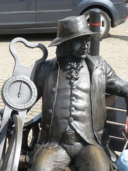
Blind Jack in the Market Square from Wikimedia
Descent of Water Bag Bank, Knaresborough (yellow).
Click on the square box bottom right to get full screen, well worth it!
This was really just a bit of fun, to see if I could negotiate a steep incline on damp, mossy round cobbles.
The first part from Market Square and down Kirkgate is pretty easy. Nice gently sloping tarmac with enough visibility even if a bit narrow. Then, at 0:38, the railway acts as a blockage. I believe the crossing gates where locked so we had to go underneath. Note that it's not easy to get even a light bike through here, let alone if you had shopping as well.
At 0:59 it's great to see houses still decked out with Tour de France bikes and bunting from the summer. However, this is the beginning of Water Bag Bank and cobbles. Just to the right of the yellow car is a walkway that is a route for riding as well I believe. That's the sensible way down. But I didn't want "sensible" right now. Also looking at the houses gives some idea of the incline here.

Water Bag Bank from Geograph
I was on the brakes all the way down here. There's no way I'd let go as I'd never get it back after a millisecond of acceleration. I finally let go when I've got a few yards of cobble left, see how quickly I gain speed!
Finally back along Waterside to the bridge next to Mother Shipton's Cave.
Return using Beryl Burton Cycleway (red).
Sadly the camera had (surprisingly) run out of battery by now. The Beryl Burton Cycleway starts along the riverbank from the bridge next to Mother Shipton's Cave then swiftly turns up and out of the gorge. This is a little steep but isn't for that long. This is followed by a steady slight climb across a field and along a track until reaching Bilton Hall Drive.

Beryl Burton Cycleway from Geograph
From here there's about a mile of track steadily improving to a good road surface passing Bilton Park until the Nidderdale Greenway crosses, as seen at 5:15 on the Ripley to Knaresborough on the Old Railway (blue) clip.
Hedgehog Cycling have a good write up of the Beryl Burton Cycleway.
Encouraging Cycling
The people riding with me are newly returned to cycling. They were excited when this trail was opened and asked me to come up and ride it with them. Our experiences of it were positive with some low points.
- Width restrictions are a very big negative on rides like this. I understand why some people think there's a need, but when it makes it as difficult at it did at points, it rather belies the original purpose.
- A lack of signage at the end of routes is also not great. There may have been routes onwards into that part of town or not, we had no idea.
- Also, just ending a route at a busy road is another big negative. Joined up routes are a nice add-on, they're a requirement.
On the postive side, it's a great off-road route away from traffic. The other route into town offers a genuine alternative to queueing in cars on the way into Harrogate, queueing to get into the car park, paying for it, then queueing on the way out again. I say this as that's exactly what my friends plan on doing, using it as an alternative way to go shopping in town. Well done, Harrogate, you've made your town centre a more attractive destination to shoppers.
Next post: A look at experiences of people taking up cycling this year.
No comments:
Post a Comment